So I began my residency… with getting Covid!
This meant that the first two weeks have been less ‘hands on’ than hoped, but it has also given me time to properly research a lot of background material and get a sense of just how incredibly complex the issues around human interference in space are. In this post I am going to attempt to summarise my reading and thoughts after looking at various perspectives and data.
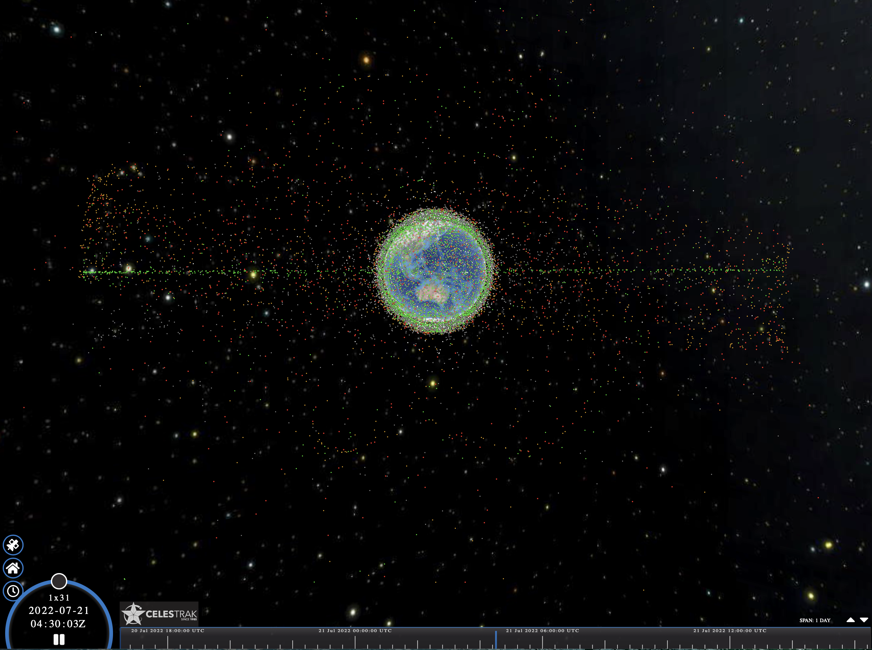
In the future, at least 1 in 14 ‘stars’ may be a satellite
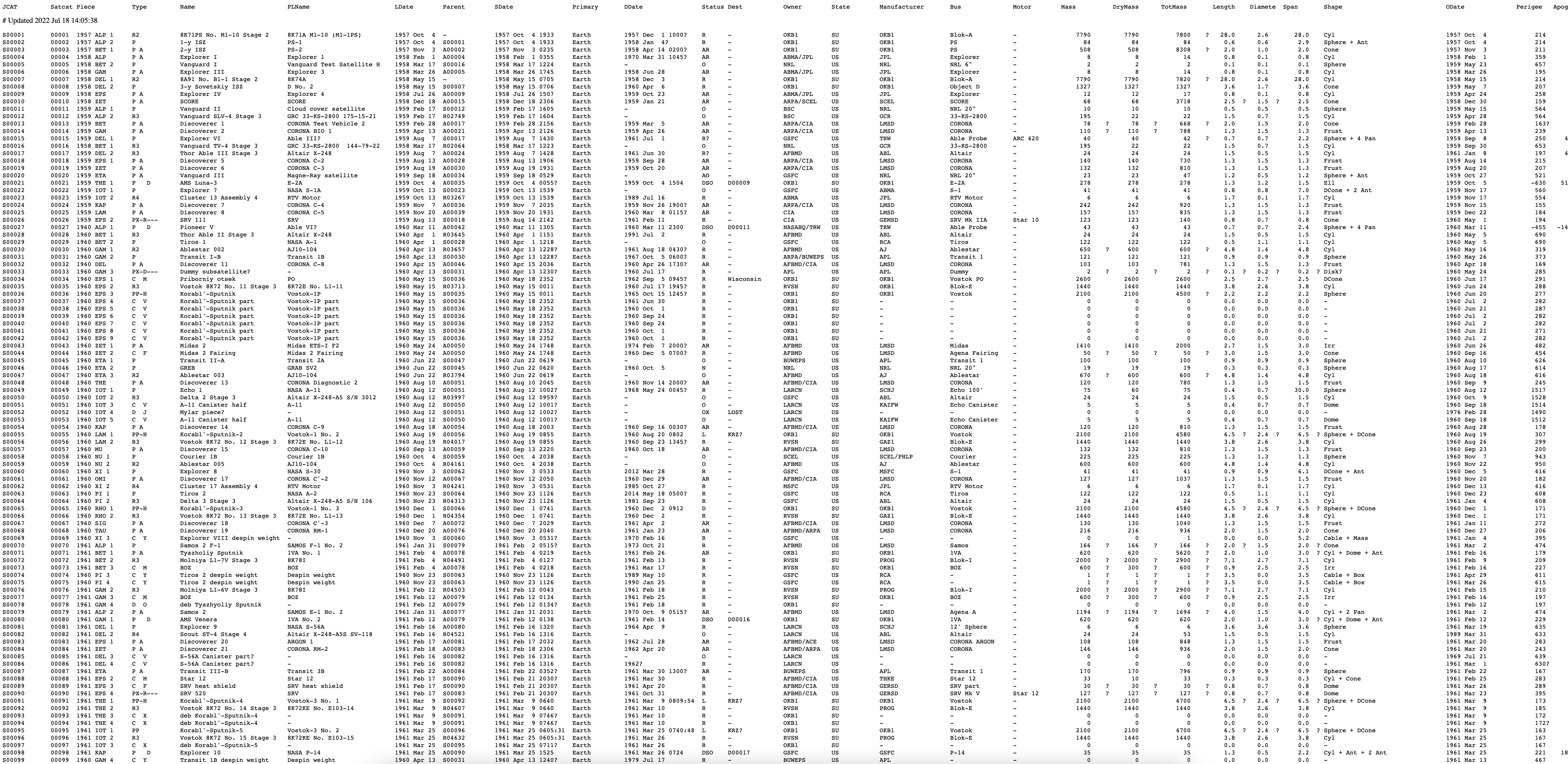
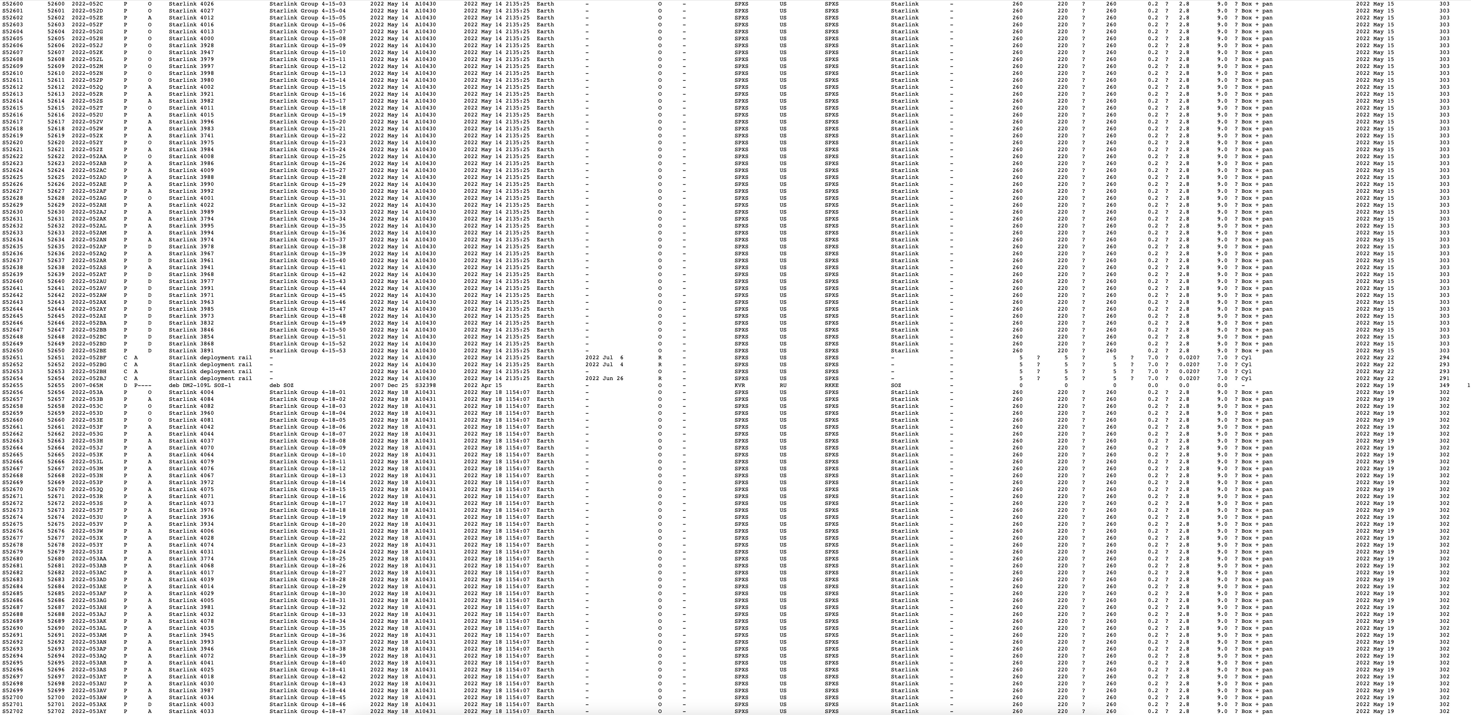
Starlink is not transparent with their statistics about how many satellites are being launched and are in orbit, but several other sites publish frequently updated datasets (eg. Starlink Watch and Celestrak) According to Jonathan McDowell’s statistics, as I write this there are currently 2603 Starlink satellites in orbit and 427 from OneWeb, so at least 3000 from those two companies alone. Starlink’s end-goal is for 42,000. Lawrence et al. cite estimates of at least 100,000 communication satellites in action by 2030 (Lawrence et al., 2022, p. 428).
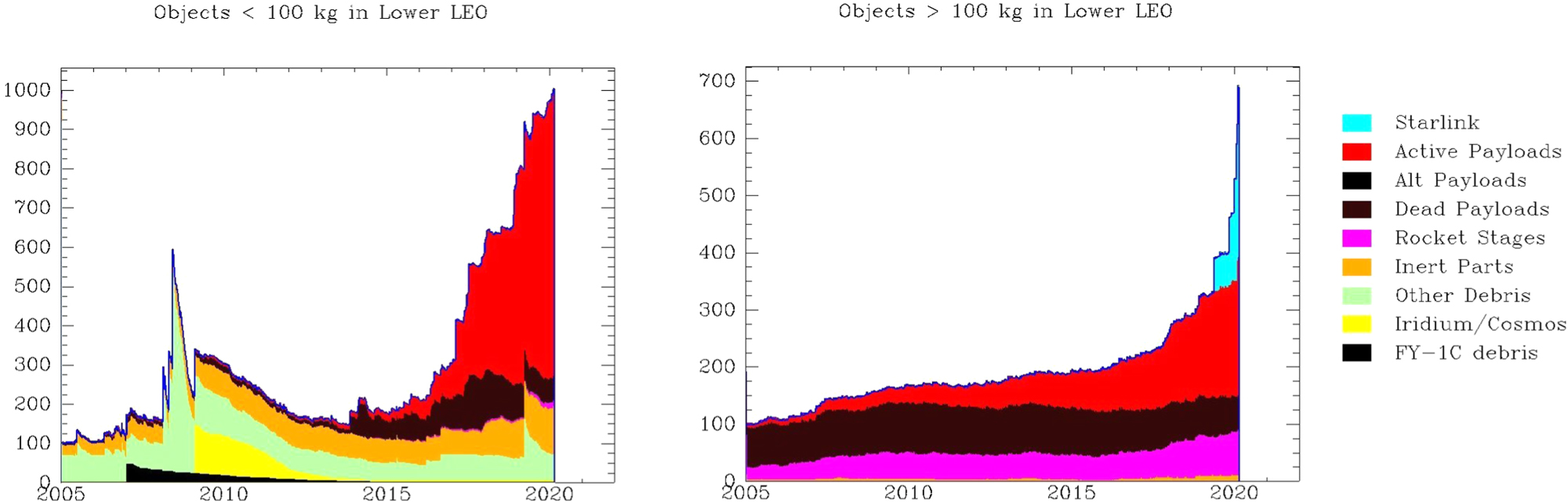
These graphs shows the massive uptick of satellites due to Starlink in Lower Earth Orbit (LEO) – note the huge blue spike on the right:
Satellites are most visible in the first few hours after sunset and before sunrise, because while it is dark on Earth at that time, the satellites are high enough above Earth to still catch the sunlight and reflect it back down to Earth. This is explained well for lay audiences in Andy Lawrence’s Losing the Sky.
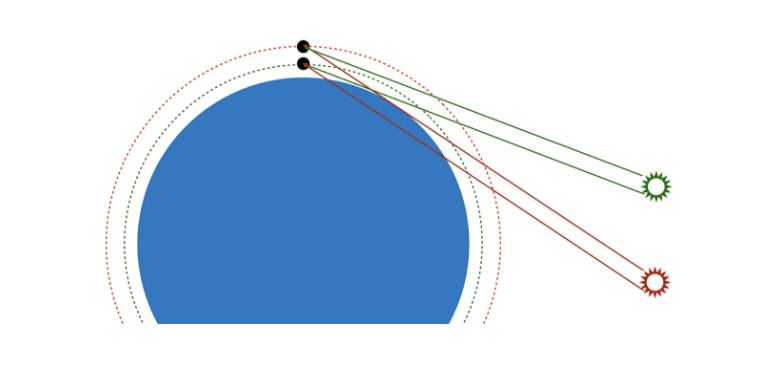
This means that locations closer to the North and South poles will be affected more during their summer months, because they have greater exposure to sunlight during that time. Lawrence also explains that satellites fly at lower orbits to achieve and provide faster internet connectivity. In terms of light pollution, lower orbit satellites are brighter but faster, which causes less damage to scientific images, while higher altitude satellites are more disruptive to optical astronomy imaging but less obtrusive to naked-eye stargazing (Lawler et al., 2022, p.11).
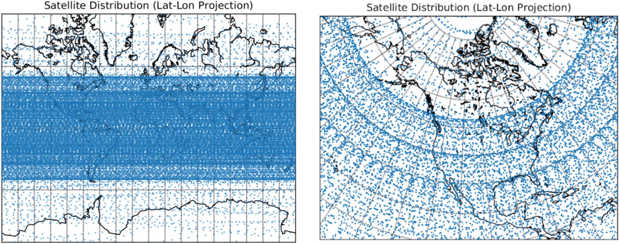
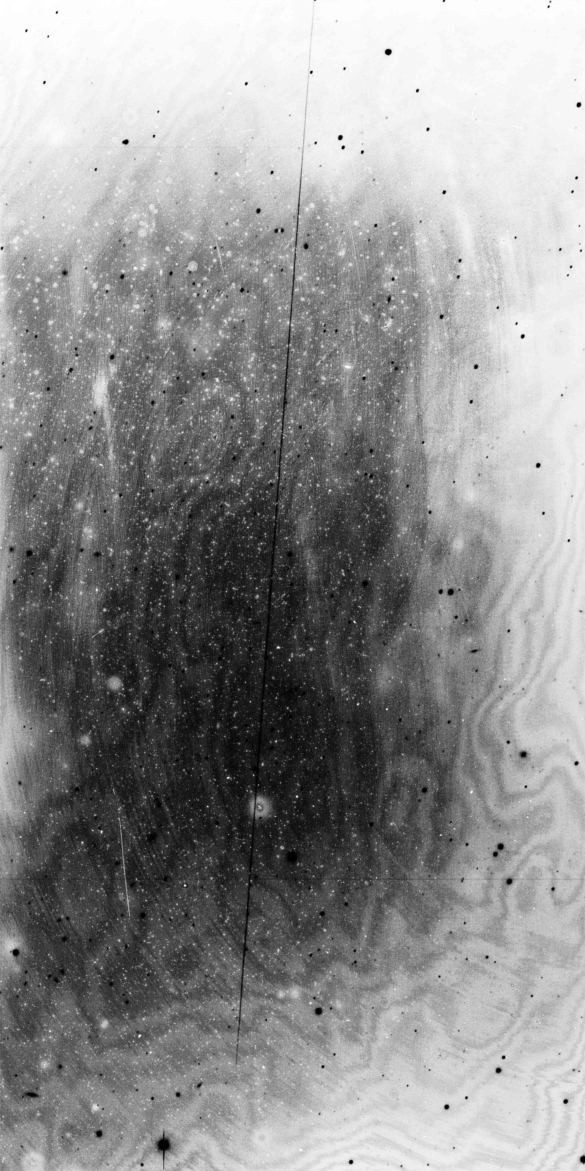
To look at cumulative effects, Lawler et al. have simulated the brightnesses and the future sky distribution for an estimated 65,000 satellites, and show that latitudes at 50 degrees north and south (pictured below) will be most impacted by light pollution from sunlit satellites. In their simulation, 1 in 14 stars in the sky will be a satellite within the hours around sunrise and sunset at times around the summer solstice.
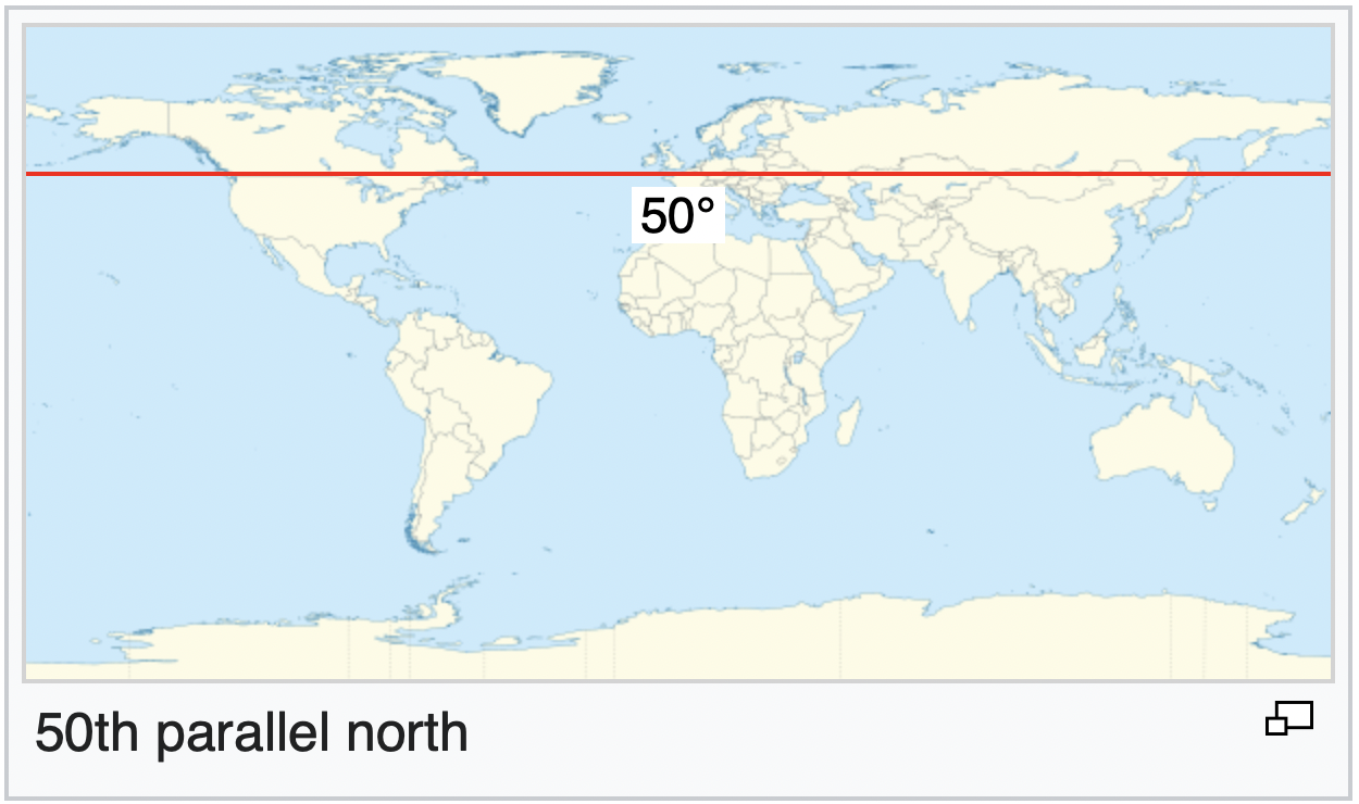
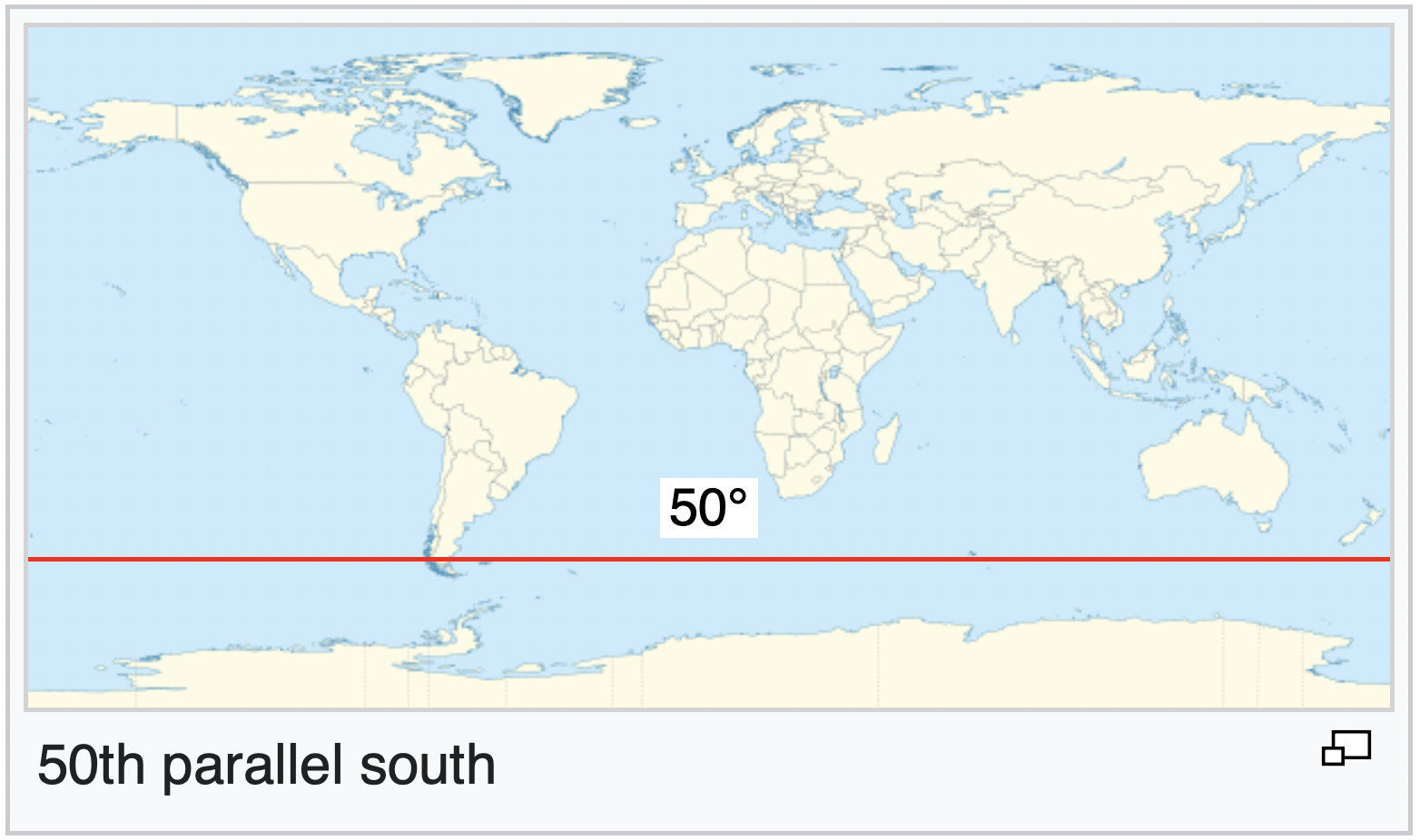
Many observatories in Canada are at around 50th parallel north. In Australia, Tasmania is at -42 degrees latitude.
Hainaut and Williams’ simulation model of 26,000 satellites shows that wide-field imaging will be severely affected, and estimate 50% of exposures in this sort of research (eg. such as the work carried out at the Vera C. Rubin Observatory opening next year) during astronomical twilight, may be ruined (Hainaut and Williams, 2020, p. 11).
Lawler et al.’s research in particular highlights that solving one specific problem will have other impacts elsewhere – this is a truly transboundary problem, for which there is no perfect solution.
What goes up must come down?
When Starlink reaches full capacity around 10% of its satellites will be de-orbiting at any one time. Boley and Byers describe that the first stages of SpaceX rockets are usually landed and re-used, and the second stages fall into remote areas of the ocean (Boley and Byers, 2021, p. 4).
While re-using is great, depositing pollution from the sky directly into the sea is not so great, an impact that Boley and Byers also note could be significant especially if the satellites contain hazardous material such as unused fuel. Their research states that:
“Starlink satellites have a dry mass of about 260 kg; 12,000 satellites will total 3100 tonnes. A 5-year cycle would see on average almost 2 tonnes re-entering Earth’s atmosphere daily.” (Boley and Byers, 2021, p. 4)
Following this, satellites are mostly made of aluminium, and “each mega-constellation will produce fine particulates that could greatly exceed natural forms of high-altitude atmospheric aluminium deposition” … and then:
“Anthropogenic deposition of aluminium in the atmosphere has long been proposed in the context of geoengineering as a way to alter Earth’s albedo. These proposals have been scientifically controversial and controlled experiments encountered substantial opposition. Mega-constellations will begin this process as an uncontrolled experiment.” (Boley and Byers, 2021, p. 4)
Massive red flag!!
And if that’s not enough, there will also be a 45% probability of collision on Earth causing one or more human casualties per de-orbit cycle 😳
Mitigation strategies
The SATCON1 workshop in 2020 presented 10 recommendations for both scientific and satellite industry communities for mitigating the impacts of satellites on optical astronomy.
The recommendations (many of which are already being developed) include:
- improved design of satellites to minimise brightness and ensure it varies slowly to avoid glints or flares;
- improve positional information to allow more accurate prediction of satellite passages;
- build a comprehensive network of observers to measure the effectiveness of satellite design;
- develop software tools to mask and remove satellite trails from images,
- and analyse the scientific impact of corrections to affected data.
Different working groups presented responses to these recommendations at SATCON2 in 2021. Some things I am particularly interested in are:
A new globally coordinated ‘public observing’ initiative is proposed. ‘SatHub’ will include astronomical data repositories, an ‘orbital solution portal’, training resources, and platforms for real-time collaboration. I am fascinated by the idea of an observatory for human made ‘stars’.
Trailblazer is currently being developed as an online repository of astronomical images containing satellite trails.
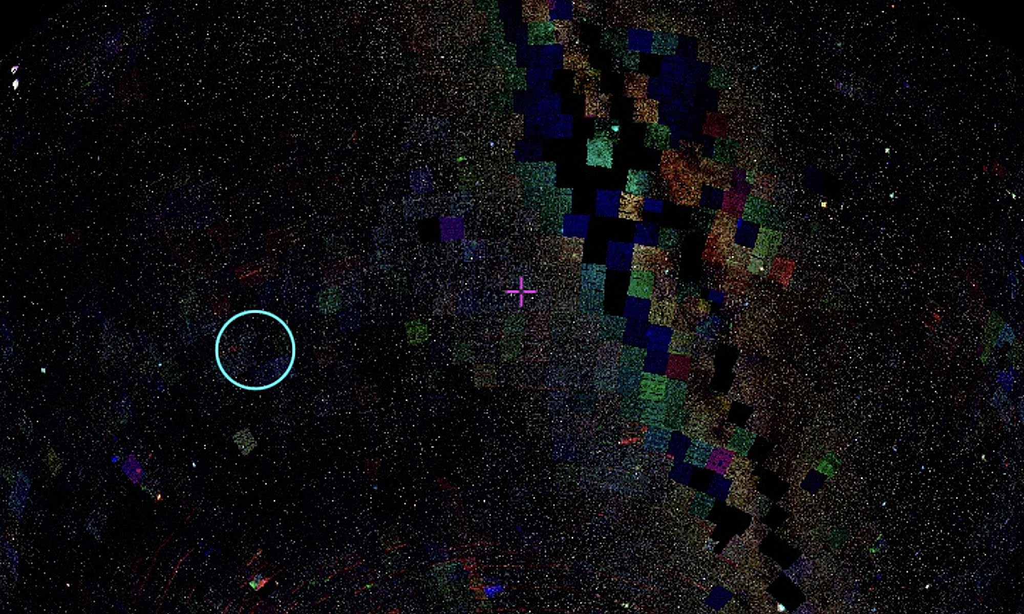
Instrument: MOA-cam3
Telescope: MOA-II telescope
Science Program: A3671-C2018_F4-R-3
While the report emphasises that no set of software tools will fix the problem, I am particularly interested in the AI software tools proposed. Machine learning models are being built to predict when areas of the sky will be affected by satellites, and recognise and flag satellite trails in optical image data.
While astronomical images are already constructed, this further ‘photoshopping’ further distances the observational image from reality. What does this mean for the role of images and the politics of what they represent? Does it become about altering reality on a planetary scale?
Radio astronomy
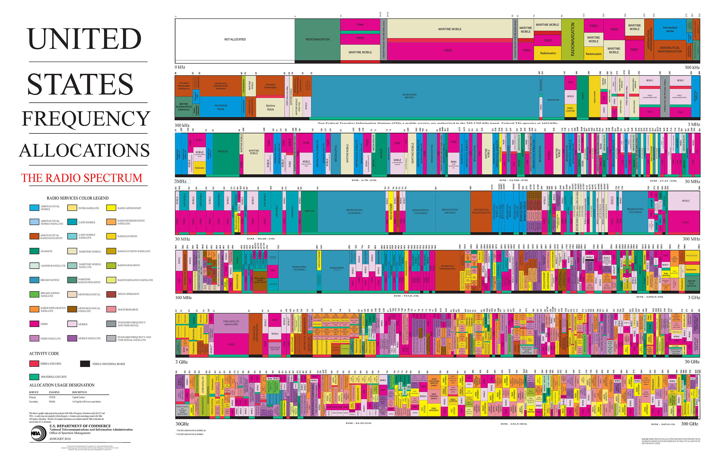
While the optical interference described so far comes and goes, and varies over time, the impact on radio astronomy will be constant and intrusive. Radio astronomy antennas rely on very sensitive detection of faint celestial objects. Regulation of the radio spectrum designates some protected frequency bands for radio astronomy, but this strategy is designed for older narrow-band systems rather than current broadband technologies. Meaningful protection zones now rely on geographical zones which are only provided in some parts of the world, and do not protect from satellite interference.
“Satellites using radio signals to relay data back and forth with ground stations and end-user antennas. Detecting faint celestial objects against this anthropogenic background can be potentially very problematic, as the emissions from satellites can easily be a trillion times louder than the astronomical targets” (Lawrence et al., 2022, p. 431)
Radio Frequency Interference (RFI) is a bigger beast I will be looking into in the weeks to come.
Orbital space and the ecosystem
That there is protection around radio frequency interference coming from Earth but not the atmosphere highlights another persistent question around how orbital space is represented and negotiated as part of the Earth’s ecosystem and environmental law. Many policies about who can put what into space are based on treaties from the 60s and 70s, and a lot has changed since then.
Indigenous perspectives consistently show that the sky is part of Country (Noon and de Napoli, 2022), but to Western knowledge systems, astronomers are having to argue for extending the definition of the term ecosystem to include Orbital space (Lawrence et al., 2022, p. 429). While the importance of space sustainability is widely recognised, there are not explicit world-wide policies and protocols.
“Establishing the principle that space activities are subject to environmental laws such as the US National Environmental Policy Act (NEPA) would be a key step in translating such international good wishes into concrete action.” (Lawrence et al., 2022, p. 429)
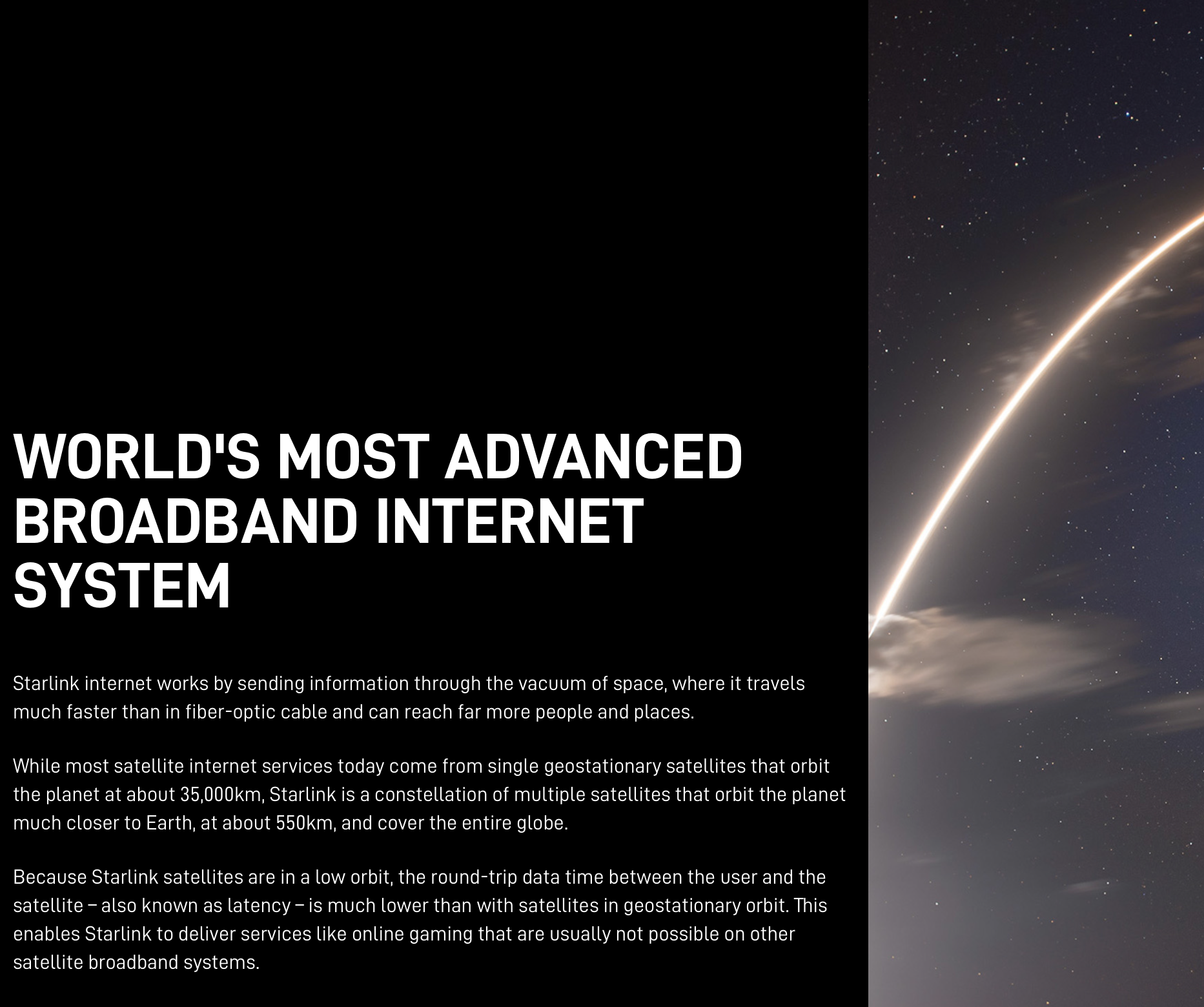
The (perceived) necessity of satellite Internet
The aim of mega constellations is to provide fast internet, everywhere.
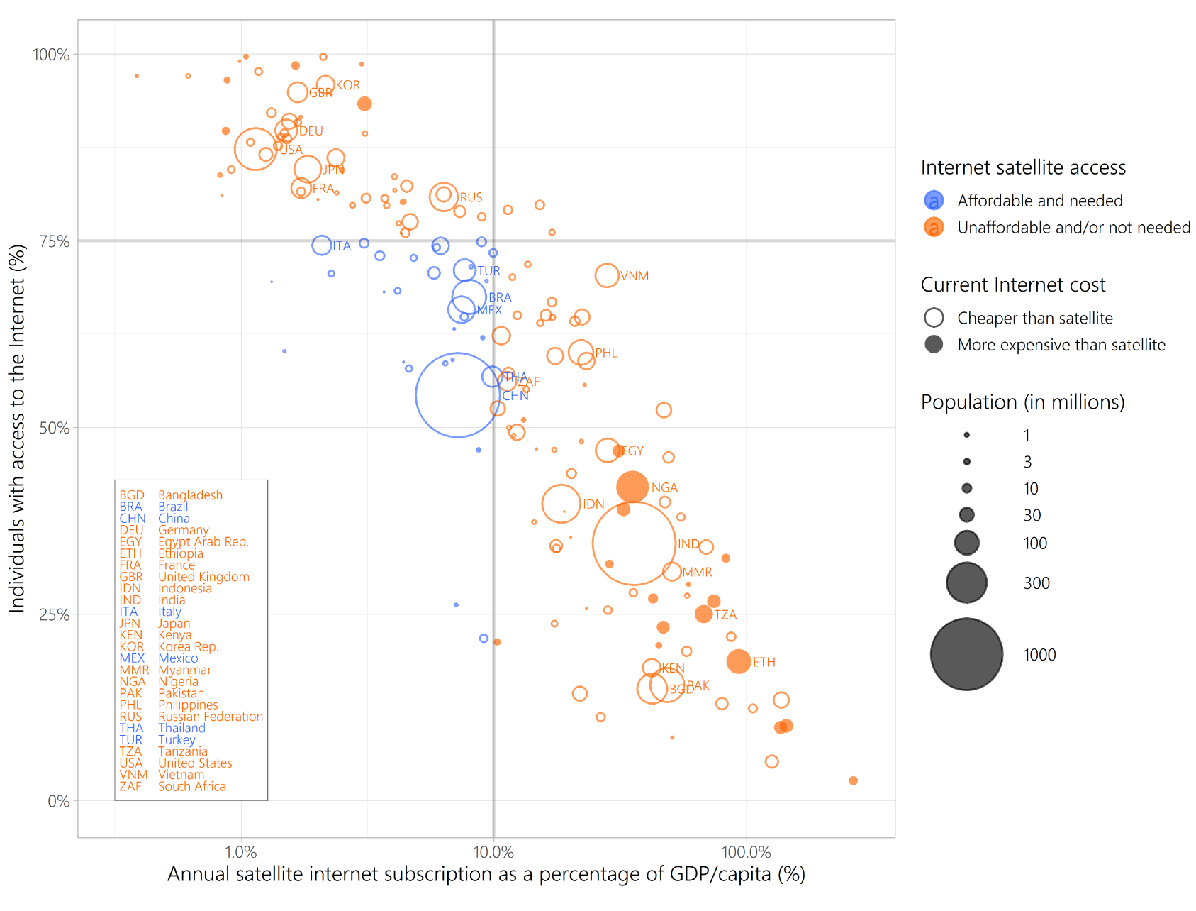
I believe Internet access is crucial for developing countries to have access to communication services and education resources. However, research from Rawls et al. shows that the cost of satellite internet, in this case the $80 per month pricetag of Starlink, is not affordable to the communities that actually need it, even if it was subsidised.
This seems like a pretty big mismatch in the problem and the proposed solution. It also points to our obsession with speed, and signals the mismatch in temporalities that underpins Rob Nixon’s concept of ‘slow violence’, which I have been considering in the context of megaconstellations, as does Hamacher et al. in their powerful paper ‘Whitening the Sky: Light Pollution as a Form of Cultural Genocide’. Nixon writes:
“Ours is an age of onrushing turbo-capitalism, wherein the present feels more abbreviated than it used to – at least for the world’s privileged classes who live surrounded by technological time-savers that often compound the sensation of not having enough time. Consequently, one of the most pressing challenges of our age is how to adjust our rapidly eroding attention spans to the slow erosions of environmental justice.” (Nixon, 2011, p. 8)
The first thing Brad and I will be doing with telescope time at the Observatory is deliberately capturing images of the satellites that are usually avoided. Brad pointed out that this will cause the satellite to be in focus, and the stars to be blurry, or streaked – which is interesting considering the discrepancies between time scales that are at play.
From here I plan to look more into how satellites are embedded in processes of both giving and taking, sensing and contributing, seeing and being seen. They contribute to how we perceive planetary scale in terms of both the technosphere and natural ecosystem, at once extracting and providing for both these realms.
References
Boley, Aaron C., and Michael Byers. “Satellite Mega-Constellations Create Risks in Low Earth Orbit, the Atmosphere and on Earth.” Scientific Reports 11, no. 1 (December 2021): 10642. https://doi.org/10.1038/s41598-021-89909-7.
Hainaut, Olivier R., and Andrew P. Williams. “Impact of Satellite Constellations on Astronomical Observations with ESO Telescopes in the Visible and Infrared Domains.” Astronomy & Astrophysics 636 (April 2020): A121. https://doi.org/10.1051/0004-6361/202037501.
Hall, Jeffrey, Constance Walker, Meredith Rawls, Jonathan McDowell, Robert Seaman, Aparna Venkatesan, James Lowenthal, Richard Green, Kelsie Krafton, and Joel Parriott. “SATCON2: Executive Summary.” Bulletin of the AAS, November 18, 2021. https://doi.org/10.3847/25c2cfeb.4554c01f.
Hamacher, Duane W, Krystal De Napoli, and Bon Mott. “Whitening the Sky: Light Pollution as a Form of Cultural Genocide” 1 (n.d.): 7.
Lawler, Samantha M., Aaron C. Boley, and Hanno Rein. “Visibility Predictions for Near-Future Satellite Megaconstellations: Latitudes near 50° Will Experience the Worst Light Pollution.” The Astronomical Journal 163, no. 1 (January 1, 2022): 21. https://doi.org/10.3847/1538-3881/ac341b.
Lawrence, Andy, Meredith L. Rawls, Moriba Jah, Aaron Boley, Federico Di Vruno, Simon Garrington, Michael Kramer, et al. “The Case for Space Environmentalism.” Nature Astronomy 6, no. 4 (April 2022): 428–35. https://doi.org/10.1038/s41550-022-01655-6.
Lawrence, Andy. Losing The Sky. Edinburgh: Photon Productions, 2021. https://andyxlastro.me/losing-the-sky/
McDowell, Jonathan C. “The Low Earth Orbit Satellite Population and Impacts of the SpaceX Starlink Constellation.” The Astrophysical Journal 892, no. 2 (April 6, 2020): L36. https://doi.org/10.3847/2041-8213/ab8016.
Nixon, Rob. Slow Violence and the Environmentalism of the Poor. First Harvard University Press paperback edition. Cambridge, Massachusetts London, England: Harvard University Press, 2013.
Noon, Karlie, and Krystal De Napoli. Astronomy: Sky Country. First Knowledges, 4. Port Melbourne, VIC: Thames & Hudson Australia, 2022.
Rawls, Meredith L., Heidi B. Thiemann, Victor Chemin, Lucianne Walkowicz, Mike W. Peel, and Yan G. Grange. “Satellite Constellation Internet Affordability and Need.” Research Notes of the AAS 4, no. 10 (October 28, 2020): 189. https://doi.org/10.3847/2515-5172/abc48e.